
Find Your Way Around Playa's Streets
Calles, avenidas, Quinta, Highway 307, “entre” and all those numbers. Once you understand Playa’s basic street pattern, addresses become much easier to decode.
 Reviewed for Accuracy
 Last Verified: October 6, 2026
 No Login. Just Answers.
 Quick Answer
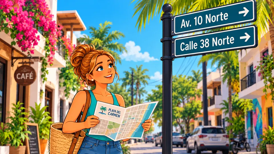
Playa del Carmen’s central street grid is much easier to understand once you know two things: Calles (KAH-yehs) generally cross the city toward and away from the Caribbean, while Avenidas (ah-veh-NEE-dahs) generally run roughly parallel to the coast.
In the older central part of Playa, many streets follow a numbered grid. You’ll see Calles 2, 4, 6, 8, 10 and so on, crossed by avenues such as 5, 10, 15, 20 and 30.
But modern Playa has grown far beyond that original grid, so you’ll also encounter major named roads, higher-numbered avenues and neighborhoods with their own street systems.
The trick isn’t memorizing every street. It’s learning how Playa describes locations.
The Simple Rule
- Calles generally take you toward or away from the beach.
- Avenidas generally take you along the city, roughly parallel to the beach.
- That’s a great navigation shortcut in central Playa, not a promise that every road in the entire city follows a perfect grid.
How to Read a Playa Address
Most central Playa addresses follow the same shape: the street you want, then the two cross streets your block sits between.
Example address
Calle 38 Norte entre 5ª Avenida y 10 Avenida
- Calle 38 Norte
- This is the street you’re looking for.
- Entre
- Between
- 5ª Avenida
- One end of your block (Fifth Avenue, Quinta)
- 10 Avenida
- The other end of your block (Tenth Avenue)
Start With the Caribbean
This may sound almost too simple, but the Caribbean is the easiest orientation tool in Playa.
If you’re downtown and know which direction the beach is, you can usually get your bearings without knowing north from south.
Quinta Avenida sits close to the coast and runs roughly parallel to it. As you move through the traditional central grid to higher-numbered avenues, you’re generally moving farther inland.
That is an extremely useful mental model. It is not a scale map of the entire city.
The Playa Compass
Orientation only — not to scale- 5ª Avenida / Quinta Avenida
- 10 Avenida
- 15 Avenida
- 20 Avenida
- 25 Avenida
- 30 Avenida
- Farther inland
- Federal Highway 307
- Farther west into residential Playa
Calles vs. Avenidas
The Spanish itself is easy: “calle” — “street” (KAH-yeh) and “avenida” — “avenue” (ah-veh-NEE-dah). You’ll often see them abbreviated as C. or Calle, and Av. or Avenida.
In the traditional central grid, Calles and Avenidas generally cross one another. So Calle 20 con Avenida 30 means the intersection of Calle 20 and Avenida 30.
Once you understand that, a lot of Playa addresses become much less intimidating.
- Calle
Street
Generally crosses the traditional central grid toward or away from the Caribbean.
- Calle 10
- Calle 38
- Calle 46
- Avenida
Avenue
Generally runs roughly parallel to the coast in the traditional central grid.
- Quinta Avenida
- Avenida 10
- Avenida 30
A helpful central-Playa pattern, not a universal citywide rule.
The Numbered Grid: Patterns, Not Rules
In much of central and northern downtown Playa, you’ll notice streets such as Calle 2, Calle 4, Calle 6, Calle 8, Calle 10 and Calle 12. That is a real and useful pattern.
But don’t turn it into “All Playa streets are even numbers.” They aren’t. Outside the familiar central grid, and even in some parts of it, you’ll encounter odd-numbered streets, Bis streets, named streets and completely different neighborhood street systems.
The avenues work the same way. The familiar central grid includes 5 Avenida, 10 Avenida, 15 Avenida, 20 Avenida, 25 Avenida and 30 Avenida, which makes it tempting to say “Playa’s avenues go up by fives.” That’s a useful beginner’s shortcut in the traditional grid. It is not a universal rule.
Elsewhere in Playa you’ll encounter higher-numbered avenues such as 70, 80, 85, 90, 115, 125, 130, 135 and 140, along with many named roads.
Learn the pattern, then learn the exceptions
Even-numbered Calles and avenues in steps of five are recognizable central-Playa patterns, not citywide numbering laws. Use them to get your bearings, not to guess an address you haven’t checked.
Entre, Con & Esquina
Three small words make most Playa addresses readable.
Entre (EN-treh) means “between.” So Av. CTM entre Av. 115 y Av. 125 means Avenida CTM between Avenues 115 and 125. This isn’t just textbook Spanish: Playa’s own municipal government uses this style when it publishes official addresses.
Con (kohn) literally means “with,” but in an address it commonly identifies an intersection. 5ª Avenida con Avenida Juárez means Fifth Avenue at Avenida Juárez.
Esquina (ehs-KEE-nah) means “corner.” Calle 20 esquina Avenida 30 means the corner of Calle 20 and Avenida 30.
- Entre
between
- Calle 38 entre Quinta y Décima
- Con
at / with (an intersection)
- CTM con Avenida 115
- Esquina
corner
- Calle 20 esquina Avenida 30
Norte, Sur & Bis
You’ll frequently see Norte (north) and Sur (south), as in Calle 2 Norte or Avenida 15 Sur. These designations help distinguish portions of Playa’s street system, and Avenida Juárez is an especially useful reference in the older central layout.
But for everyday navigation, don’t panic if you can’t immediately visualize north and south. A destination’s cross streets, neighborhood and map pin are often more useful than mentally calculating compass directions.
You’ll also occasionally see Bis, as in Calle 6 Norte Bis or Calle 14 Norte Bis. Bis identifies an additional, intermediate street inserted into the numbering system. Playa’s own municipal market of La Diez is listed by the city as “avenida 10 entre calle 6 norte y 6 norte bis.”
For practical navigation, the important thing is: Calle 14 Norte and Calle 14 Norte Bis are not the same street. If your destination says “Bis,” don’t casually drop that part of the address.
Major Streets Worth Knowing
You don’t need to memorize Playa’s street list. A handful of well-known corridors will orient you in most conversations.
- Quinta Avenida
Fifth Avenue: 5ª, 5ta, 5 Avenida, La Quinta
Playa’s famous tourism corridor, running roughly parallel to the Caribbean. It isn’t just the handful of restaurant, shopping and nightlife blocks most visitors first see: it continues north well beyond the busiest tourist core.
- Avenida Juárez
Avenida Benito Juárez
One of Playa’s most useful historic reference streets. Its coastal end brings you into the Parque Fundadores and ferry area, and it continues inland across the city. “North of Juárez” or “south of Juárez” already narrows a location considerably.
- Avenida 10
Tenth Avenue
Runs parallel to Quinta through much of central Playa. Addresses “between Quinta and Avenida 10” are extremely common, and because Quinta has major pedestrian sections, Avenida 10 can be the more useful reference by car.
- Avenida 30
Thirtieth Avenue
Another major corridor running roughly parallel to the coast, farther inland than Quinta and Avenida 10. It works much more like an everyday city avenue than a tourist promenade, and quickly becomes an “okay, I know approximately where that is” road.
- Constituyentes
Avenida Constituyentes
A major cross-city corridor running from the coastal, tourist part of Playa inland, across the major avenues and Highway 307. People simply say “Constituyentes” rather than fitting it into the numbered pattern. That’s normal.
- CTM
Avenida CTM
A major cross-city corridor in northern Playa. It crosses Quinta, Avenida 30, Highway 307 and Avenida 115, and continues through residential Playa. “Up by CTM” becomes meaningful local shorthand.
- Avenida 28 de Julio
An important inland route
A good example of why names need context: “28 de Julio” also appears in other Playa place names, so check whether someone means the avenue or something else with the same name.
Highway 307
Federal Highway 307 is impossible to ignore. It runs north–south through Playa and has long been one of the city’s major geographic dividing and reference corridors.
You may hear it called Highway 307, Federal Highway 307, Carretera Federal 307 or simply la carretera. Don’t assume two people are talking about different roads just because they use different names.
That leads to some of the most useful everyday navigation language in Playa. Instead of east or west, someone may simply say toward the beach (hacia la playa) or toward the highway (hacia la carretera). For many newcomers, those directions are much easier to picture than compass points.
Avenida 115 / Arco Vial
Once you’re farther inland, Avenida 115 becomes an important reference corridor. You’ll also hear it called the Arco Vial: the municipal government itself describes Avenida 115 as “conocida de igual manera como el Arco Vial de la ciudad” (also known as the city’s Arco Vial).
So 115, Avenida 115 and Arco Vial can all point you to the same corridor.
Playa Isn’t One Giant Numbered Grid
This is one of the most important lessons in this article. The traditional numbered Centro grid is wonderfully learnable. Modern Playa is much larger.
Newer residential areas can contain named roads, different numbering systems and street patterns specific to individual colonias and fraccionamientos.
So don’t look at Centro and assume that Villas del Sol, Ciudad Mayakoba, Xcalacoco, Ejidal, Playacar or every other part of Playa follows exactly the same street logic. They don’t.
Formal Addresses vs. Useful Directions
A Playa address may include much more than a street name. You may see Colonia, Fraccionamiento, Residencial, Supermanzana, Manzana and Lote, which identify different neighborhood, development and property units.
Manzana means block and Lote means lot, so Mza. 12, Lote 5 means Block 12, Lot 5. That’s very useful on property documents and utility records, and much less useful to the person delivering your dinner.
Here’s a real example, the municipal government’s own address for its urban development office: “Avenida CTM entre Avenida 115 y Avenida 125 norte, Manzana 001, Lote 22, Supermanzana 053, Fraccionamiento La Gran Plaza de la Riviera.” For everyday navigation, CTM entre 115 y 125 plus the destination name usually does the job.
Mexico does have official street numbering, and Playa’s municipal government issues a Constancia de Número Oficial (official number certificate) for a property. But in daily life, cross streets and recognizable destinations still matter a lot.
You may also have a property address, a postal address, a utility-service address, a condo development’s address, a Google Maps listing and a pin someone sent you, and they may not all be written identically. That doesn’t automatically mean one is wrong. For official or legal purposes, use your official documentation. For getting someone to your door, a good pin often wins.
Formal address may include
- Street
- Cross streets
- Colonia / Fraccionamiento
- Supermanzana
- Manzana
- Lote
- Official number
Getting someone there usually takes
- Destination name
- Street
- Cross streets
- Area
- Map pin
The takeaway
The legally complete address and the most useful directions are not always the same thing.
Send the Pin
 When you give an address to a taxi or driver, you don’t need to recite a formal property description. Usually the useful information is destination + street or cross streets + area.
For example: Calle 38, entre Quinta y Décima, por favor (Calle 38, between Fifth and Tenth, please). Or simply: CTM con 115 (CTM and 115).
And if the driver isn’t sure, show or send the pin. Our Getting Around guide covers taxis, inDrive and colectivos in more detail.
Ask Playa Tip: A pin beats an address surprisingly often
If you’re giving directions to a taxi, inDrive driver, delivery person, contractor or friend, send the location pin whenever possible. An address tells someone what the place is called. A good pin tells them where to go.
For large properties like hospitals, resorts, condominium complexes, beaches or shopping centers, even the ordinary property-center pin may not be the best arrival point. That’s why Ask Playa distinguishes between a map location and a practical Directions location when necessary.
Useful Spanish for Directions
A few words and phrases cover most address conversations. Tap a speaker button to hear the ones with audio.
- “¿Dónde está…?” — “Where is…?”
- “¿Cómo llego a…?” — “How do I get to…?”
- “En la esquina” — “On the corner”
- “Le mando mi ubicación por WhatsApp” — “I’ll send you my location on WhatsApp”
- Está entre Quinta y Décima. It’s between Fifth and Tenth.
- Está en la esquina. It’s on the corner.
- hacia la playa: toward the beach
- hacia la carretera: toward the highway
- entre: between · con: with / at the intersection of · esquina: corner
- “calle” — “street”
- “avenida” — “avenue”
How the Areas Map Fits In
Street addresses tell you where something is. Neighborhoods help tell you what part of Playa you’re in.
The Areas of Playa map shows Playa’s primary areas, including Centro, Gonzalo Guerrero, Zazil-Ha, Luis Donaldo Colosio, Ejidal, Playacar, Xcalacoco, Villas del Sol, Ciudad Mayakoba and others.
Area boundaries and the street network serve different purposes. A street can pass through several areas, and a major avenue can form part of an area’s edge: Constituyentes, for example, is where Centro ends and Gonzalo Guerrero begins. So a destination can be described both ways: “It’s on Avenida 30 in Gonzalo Guerrero.”
Quick Cheat Sheet
- Calle
Street
- Avenida
Avenue
- Entre
Between
- Con
Commonly used to describe an intersection
- Esquina
Corner
- Norte
North
- Sur
South
- Bis
An additional, intermediate street next to the numbered street
- Quinta / 5ª Avenida
Fifth Avenue
- Carretera / 307
Federal Highway 307, the major highway through Playa
- 115 / Arco Vial
Names you may hear for Avenida 115
- Manzana / Mza.
Block
- Lote / Lt.
Lot
The One Thing to Remember
You do not need to memorize Playa del Carmen. Learn a few anchors: the beach, Quinta, Juárez, Constituyentes, CTM, Avenida 30, Highway 307 and Avenida 115.
Then learn how to read Calle ___ entre Avenida ___ y Avenida ___. Once that makes sense, Playa stops looking like a pile of random numbers.
And when all else fails? Send the pin.
 Frequently Asked Questions
What is the difference between a calle and an avenida in Playa del Carmen?
Calle means street and avenida means avenue. In Playa's traditional central grid, Calles generally run toward and away from the Caribbean, and Avenidas generally run roughly parallel to the coast. That's a helpful central-Playa pattern, not a rule for the whole city.
What does “entre” mean in a Playa del Carmen address?
Entre means between. Calle 38 Norte entre 5ª Avenida y 10 Avenida means Calle 38 Norte, on the block between Fifth Avenue and Tenth Avenue. Playa's municipal government uses this same style in its official addresses.
Are all Playa del Carmen streets even numbers?
No. Many familiar central Calles are even-numbered (2, 4, 6, 8, 10 and so on), but Playa also has odd-numbered streets, Bis streets, named streets and neighborhoods with their own street systems.
What does “Bis” mean on a street name?
Bis identifies an additional, intermediate street inserted into the numbering system, such as Calle 6 Norte Bis next to Calle 6 Norte. They are different streets, so don't drop the Bis from an address.
What is the Arco Vial in Playa del Carmen?
Arco Vial is another name for Avenida 115, an important inland corridor. The municipal government itself describes Avenida 115 as the city's Arco Vial.
What do manzana and lote mean in a Mexican address?
Manzana means block and lote means lot, so Mza. 12, Lote 5 means Block 12, Lot 5. You'll see them on property documents, utility records and formal addresses, often with a supermanzana, colonia or fraccionamiento too.
How do I give a Playa address to a taxi or driver?
Give the destination, the street or cross streets, and the area, for example: Calle 38, entre Quinta y Décima, por favor. If the driver isn't sure, show or send the location pin.
Why doesn't my Google Maps address match my official address?
Different systems can describe the same place differently: a property address, a postal address, a utility-service address, a condo development's address and a map listing may all be written differently. That doesn't automatically mean one is wrong. Use official documents for legal purposes and a pin for directions.
 Sources
- Municipio de Playa del Carmen: Constancia de Número Oficial (official address and number process)
- Municipio de Playa del Carmen: street repaving program (Avenida 115 “Arco Vial”, CTM, Constituyentes, 28 de Julio), January 2025
- Municipio de Playa del Carmen: Av. CTM entre Av. 115 a Carretera Federal (public works record)
- Municipio de Playa del Carmen: 5ta Avenida renewal between Constituyentes and CTM (March 2023)
- Municipio de Playa del Carmen: Avenida Constituyentes connects Villas del Sol with Centro (November 2025)
- Municipio de Playa del Carmen: Mercado de la Diez, “avenida 10 entre calle 6 norte y 6 norte bis”
- INEGI: Marco Geoestadístico, Encuesta Intercensal 2025, Quintana Roo (street names, incl. numbered avenues and Bis streets)

Was This Helpful?